This trail is recognised by the Valencian Community’s Federation of Mountain Sports and Climbing.
It can be downloaded by clicking on this link: PR-CV 167
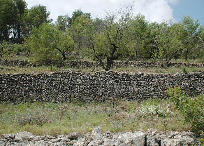
The route is just over 5 kilometres long, going from Alpatró to Benialí. The trail takes advantage of a stretch of the Gallinera River, which means that it is not usable during or immediately after heavy rains. After crossing the river, the trail passes by the location known as La Garriga, where it is possible to see the fossil remains of an old beach. Further along the trail, just before reaching the path that goes up to La Carroja, there is a threshing area with flat stones stuck into the ground so as to protect the working cattle during threshing. Looking down towards the bottom of the ravine, the remains of an old stone bridge can be seen.
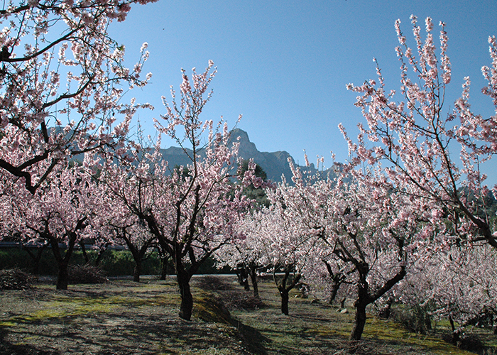
The path between La Carroja and Benialí passes through Benissivà and Benitaia, following part of the Route of the 8 Villages. During the walk there are enjoyable views of the dryland agricultural landscape of La Vall de Gallinera, where olive and cherry trees predominate.
We use cookies to enhance your experience while using our website. If you are using our Services via a browser you can restrict, block or remove cookies through your web browser settings. We also use content and scripts from third parties that may use tracking technologies. You can selectively provide your consent below to allow such third party embeds. For complete information about the cookies we use, data we collect and how we process them, please check our Privacy Policy