La Costera dels Victorinos and the rock art of Benialí
See more routes
Distance - 2,9 km
Elevation - 417 m
Technical difficulty - Moderate
La Costera dels Victorinos (the slope of the Victorinos) was one of the old roads that went from Benialí to Vilallonga. It was a path for animals, which meant that it was made to be wide and comfortable for the passage of an equine animal loaded with the farmer’s harvest. Communication between the various villages of La Vall de Gallinera and Vilallonga, belonging to the La Safor area, was quite frequent, which meant that these paths were often fairly busy. However, traffic was more common between the villages and the cultivated terraces on the surrounding slopes, so as to carry out the agricultural tasks necessary depending on the time of the year. The Solana area of the mountain range called L’Almirant has exceptional climatic and edaphic characteristics for dryland agriculture, but it also has an unfavourable factor: the relief, the steep slopes. This led to the cultivation of large swathes of rough mountains that were subdued, terraced and cultivated with good harvests, during periods when the rich had the flattest and most fertile lands. A good example of work on terraces, and the creation of agricultural space in mountainous terrain otherwise impossible to cultivate, can be found along this route both on the way up and on the way back. The ravine called Basses del Racó and the slope known as La Costera dels Victorinos are two good examples of overcoming problems, of making the most of the available territory and of fighting against the destruction of fertile land.
The trail starts in Benialí, setting off in the direction of the road known as Camí de La Solana. Once there, it is necessary to cross the road and go towards the path of the sewage treatment plant. After the plant, the trail deviates to the left along the cattle path that lies next to a ravine, which is shaded by holm oaks and leads to the river. The river has to be crossed in order to then climb slightly to the right where the trail connects with the Rock Art trail that comes from Benirrama, and at that point it is necessary to continue walking to the left. After a short while, the trail passes by the old limestone quarries, from where the inhabitants of the valley extracted many of the pieces of ashlars and the portals of houses and the sidewalks that can be seen in La Vall de Gallinera. It is possible to see signs of the stonecutting and extraction processes used in the past.
The trail continues going in a westerly direction, skirting old dryland terraces which have become wild forested areas, where olive trees, holm oaks and carob trees have optimal surroundings. The trail passes by a very large livestock pen and, if one thinks about all the corrals along the route or distributed throughout the valley, it is easy to perceive that there was a huge number of pasturing animals on these mountains.
Soon after there is a crossroads and from there the trail continues to the right. The path on the left will be used for the return, and therefore this is the fork for the start and end of the circular route. From there, the hike proceeds upwards and continues inside the Basses del Racó ravine, where it is possible to appreciate the water canals, cut into the stone to collect rainwater, and the ponds (or “basses”, in Valencian) which give the name to the ravine but are now filled with earth and stones. Along the way, there are two small springs that fill up basins for drinking, one of them open while the other has a protective dome.
Then, finally, the trail reaches the shelter, although before getting there it is possible to enjoy, from a distance, the views of the engravings of the shelter that lies just to the left of the ditch cut into the stone, a shelter which can not be accessed.
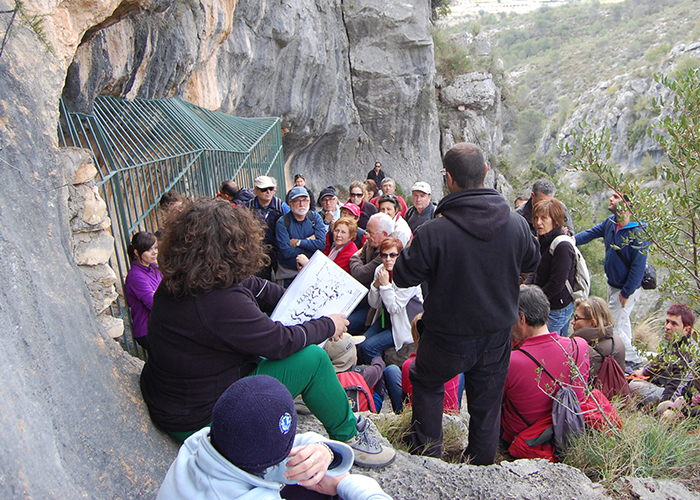
The Basses del Racó ravine is one of the most prolific ravines in terms of shelters with rock art in La Vall de Gallinera, seeing that there are five shelters with representations of macro-schematic, schematic, Levantine and engraved art, located on both sides of the ravine. Only shelter IV, which has panels for self-guided tours, can be visited.
The return trail follows the ravine upwards, along the earlier path that went uphill, until reaching the pass and changing to the other slope. The trail passes by Uncle Alberto’s thrashing square and livestock pen and goes down by way of La Costera dels Victorinos.
We use cookies to enhance your experience while using our website. If you are using our Services via a browser you can restrict, block or remove cookies through your web browser settings. We also use content and scripts from third parties that may use tracking technologies. You can selectively provide your consent below to allow such third party embeds. For complete information about the cookies we use, data we collect and how we process them, please check our Privacy Policy