The PR-CV 43 trail was designed by the hiking centre of Valencia and crosses the four valleys of the Marina Alta region. It starts in the village of Fleix in La Vall de Laguar and, after crossing the famous Barranc de L’Infern, it goes to La Vall d’Ebo, La Vall de Gallinera and La Vall d’Alcalà, ending at the top of La Safor after climbing from the old livestock pen known as Corral de Pere Jordi.
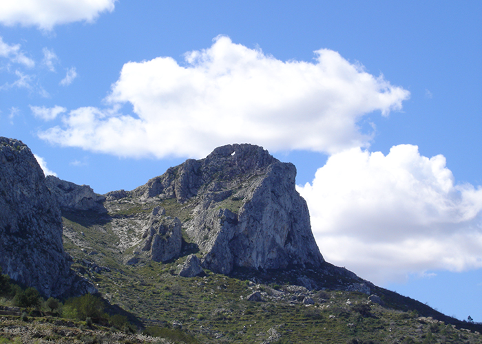
It enters La Vall de Gallinera through the area where the Benirrama pond is located and across the south-facing slope of the Foradada mountain range, from where it is possible to go to La Vall d’Alcalà or, descending through the Foradada mountain pass, reach Benissivà and Benialí. From there, the trail follows the road known as Camí de La Solana until the water pipes, from where the path climbs along the Maiolet slope until the track called Camí de La Llacuna. The path that goes up to La Safor climbs to the right, and Pere Jordi’s pen and its spectacular cistern lie on the left of the trail.
The ascending path passes through several holm oak groves, regrowing now from the stumps of dense ancient holm oak forests. These trees were highly prized in the past for the quality of the charcoal made with their wood.
Although the path lies on the south-facing slope, under the heat of the sun, it is a good hike without being too difficult if the hottest days of the summer are avoided, except perhaps during the first and last hours of a summer day.
The summit of La Safor permits spectacular views in all directions. To the east, the sea and, on clear days, the Balearic Islands; to the west, the Sierra de Mariola, Benicadell; to the south, Serrella and Aitana; and to the north, the Sierra Grossa, the whole coastal plain of the Gulf of Valencia and the Iberian mountain range. Quite a geographical enjoyment!
We use cookies to enhance your experience while using our website. If you are using our Services via a browser you can restrict, block or remove cookies through your web browser settings. We also use content and scripts from third parties that may use tracking technologies. You can selectively provide your consent below to allow such third party embeds. For complete information about the cookies we use, data we collect and how we process them, please check our Privacy Policy